Posts

Showing posts with the label walks with kids

Cort-ma Law

Image
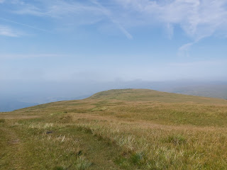
  Cort-ma Law Less than an hours drive from Glasgow, just north of Lennoxtown are the Campsie hills, which allows for a quick days hike.  Starting Point The best place to start is at the Campsie Glen waterfall car park. This can get busy, so it is best to try and get a parking space early. The walk itself starts directly opposite the car park.  Car park location Location of hill Route The track ascends immediately from the carpark travelling east, go past the old shelter covered in graffiti. Shelter Hike up from the car park The track continues upward and the track could be tricky at this point for younger walkers. The first part of the walk ends at a small cairn marker.  First marker cairn From there the hike undulates for 2km as it snakes it's way slightly south of the actual top. Here you will reach a bigger cairn marker.  Second marker cairn From this marker turn north east to the trig point 4.5 km distance. The height of the summit is 526m. We reached the t...
Beat the Street

Image
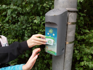
  For 6 weeks between September and October the Beat the Street game was installed in our local neighbourhood. This gave children and adults alike a chance to participate, a different take on staying healthy. The idea is simple, there was over 60 boxes in a local area  scanning a box with a special cards or fob that gives you 10 points towards your overall amount. There were different events during this time that gave double or even triple points. The rules were simple, you can walk, run or cycle between boxes,travelling by car was against the rules.  Halloween themed boxes The benefit was that it got me motivated to run in the local area, something I didn't like usually doing. It also allowed you to meet other people that was taking part. It was fun to see those that took the game seriously. Once I got into, it my aim was to break into the top 100 players. I managed this and was able to sneak into the top 50, finishing at 49 out of over 7000 players.  Leader board...

Scotland's Highest Village

Image
  Lowther Hill Radar Station Wanlockhead has the distinction of being the highest highest village in Scotland at 466m and located here are the Lowther hills. Lowther and Green Lowther hills can be spotted easily due to the radar station and aerials that are situated at the tops of these hills.  Wanlockhead Route  The Route  We  parked at the Visitor centre car park. From there we walked past the toilets, up the slope next to the playpark. We continued this across the road and up onto the open slopes, heading south east.  We were following part of the route for the Southern Upland Way, the markers were quite obvious.  Wanlockhead Village Route Markers for the SUW The track crosses over the road that leads up to the radar station and it would be possible to walk entirely on the road. The height of Lowther Hill is 725m so the accent from the village is only just under 300m.  Looking Back Down the Track Getting Closer  Road to the Station  V...

Tinto

Image
  First Hike After Lockdown The news of an another lockdown wasn't a surprise, with rising infection and death rates in December and January.   It has been tough for everyone to spend their time within their local community. Usually, it is quite  normal to spend the winter walking lower routes as the snow sweeps on across the larger hills in Scotland.  Now, as the restrictions begin to relax and the snow receeding,  it was time to get out and about. I had considered Tinto for a long time, mainly because it would also be suitable for younger children to walk. With the youngest member of the family still in nursery, we needed a hill that would be achievable to get up and down in a few hours.  Location  Tinto is situated in southern Scotland,  still within the South Lanarkshire Council area. It is located 8 miles from Lanark and stands at 711m in height. From Glasgow, head south on the M74 to junction 11. From there follow the A73 towards Bigger...

Backmuir Woods

Image
If you search for Backmuir woods you'll probably find the one in Dundee, this isn't it. The correct name for this is Whitehill walk and it is located on the outskirts of Hamilton, near the Whitehill centre.  We started at the basketball court and walked up the slope which took us to a walkway behind a school. From there we took a left and headed into the woods. Time wasn't on our side, with the nights drawn in and the rain clouds advancing, but we walked on hoping that the cover of the woods would shelter us from the elements.  The plan was to try and walk around in a loop. The ground is rather marshy and in one area there is a large puddle that is difficult to negotiate, so we were forced to take a right turn up near the industrial estate. The woods are sandwiched between this estate and the expressway.  We had reached the pipes as the rain finally began to fall. Unsure about going further and having to cross th...

The Nature Reserve at Dalzell Estate

Image
  Here we are back at Dalzell Estate, due to Covid restrictions as it was deemed necessary not to travel to far from our home. In this case we decided to travel the short distance and have a closer look at the loch and nature reserve. The last time we had a walk around the Japanese garden and the woods in general, by passing the large stately home that is almost impossible to miss. This time we headed in the opposite direction.  The Route Our route took us west from the car park and out onto open countryside and then south beside some trees. After a 1km or so it joins onto the Wetland route which, next to the loch. We continued along this path a little too long and after the first hide we should have turned left, switching back along the outer end of the loch. We had to double back on ourselves, but we had only gone 100m or so in the wrong direction.  Path Bird Hide On the far side where the path is trapped between the river Clyde and the loch, the vegetation is high here...

A Walk at Chatelherault Park

Image
  With the car out of action a short train journey was in order to visit Chatelherault country park. The bonus is that the train station is located opposite the park, which make for a very easy trip. As always, the plans in my head were for myself and the kids to have a decent walk through the woods or to a ruined castle, however the kids idea was just to visit the play park. After what felt like a very long 50 mins the kids were bored of the play park and a deal was struck about going for a walk. This is a complicated process of them not wanting to walk very far at all, and me seeing it as a chance to explore. It was decided that a walk to the Wham pond was a good compromise, a distance of 1.8km away, what a long walk! C hatelherault Park Pond Walk Route The pond is located behind the main house, where the shop and information centre is. We followed the signs that led to the overflow car park and then descended down a set of steps to the woods at the bottom of the main flat g...