Tinto

First Hike After Lockdown
The news of an another lockdown wasn't a surprise, with rising infection and death rates in December and January. It has been tough for everyone to spend their time within their local community. Usually, it is quite normal to spend the winter walking lower routes as the snow sweeps on across the larger hills in Scotland. Now, as the restrictions begin to relax and the snow receeding, it was time to get out and about. I had considered Tinto for a long time, mainly because it would also be suitable for younger children to walk. With the youngest member of the family still in nursery, we needed a hill that would be achievable to get up and down in a few hours.
Location
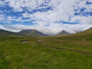
Tinto is situated in southern Scotland, still within the South Lanarkshire Council area. It is located 8 miles from Lanark and stands at 711m in height.
From Glasgow, head south on the M74 to junction 11. From there follow the A73 towards Bigger. Stay on the A73 for 11 miles. Take a left turn opposite Station Road, there is the Tinto tearoom on the corner.
The car park is large and so finding a space shouldn't be an issue. There are no amenities located at the car park but there is the tearoom, which was closed due to the current restrictions.
Route

The route starts through the gate from the car park. The track is very obvious and would be easy to navigate even in poor weather conditions. The path can be muddy and icy underfoot at the lower section, and near the top the path does have a fair amount of scree, so proper hiking boots are recommended.
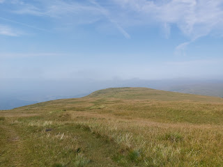
Follow the main path, it will curve to the left slightly. At 480m you will see a small cairn, which is for the lower hill, Totherin hill. The path does split after this, we continued on the main track, to the left which seemed to be better underfoot. If walking on a clear day the top is visible from a distance and getting to the summit is routine.


The loose rock will be the biggest issue, but that will be mostly during the decent. We walked it with 3 children at a decent pace and were at the top in just over an hour and a half and just under three hours in total up an down. I recorded our total accent to be 522m but other sites have the accent lower at 486m. Even so the distance of 3.7km up to the top is fairly even. The total distance walked was 7.41km

This is a good hill for a short hike with a young family. It would also be a good hill to introduce people who are new to hiking.

Comments
Post a Comment