Dechmont Hill

Walking With Kids
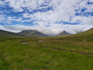
At last, after a weekend where it barely stopped raining there was a break in the weather, and a chance to get out. Dechmont hill is our closest climb and measures just under 200m, which gives the kids a chance to get to the top. We parked on the road that runs parallel behind Gilbertfield road. The walk started on the track that leads to Dechmont farm and the shooting range. They are now turning this area into housing, so be careful of builders lorries etc. We took a left turn at the road which leads to the farm, and then a right at the Dechmont Range House, now abandoned. The track ends at a small compound, but takes you past the ruins of Gilbertfield Castle.
 |
| Gilbertfield Castle |
The compound contains a couple of old houses which acts as a control station for the shooting range. There is no access through it, instead take a left turn before the end of the track and make your way through the grass. There is a path through here but can be obscured by the tall grass surrounding it.
 |
| Path through the Grass |
 |
| Shooting Areas |
Make your way past the flat areas of ground and head south west, there will be an old abandoned house with a big letter B at the top left corner.
 |
| Old House |
 |
| Track |
 |
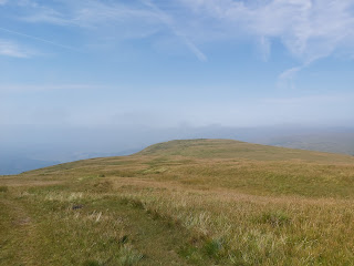
| Nearing the Top |
There is a path that leads behind the house up the hill to a gate. Climb this and continue right, almost as if you are heading away from the top of the hill. There is a faint path here, so it should be easy to navigate. There are 2 options next, use the steps cut into the steep hill side to reach the top, this can be slippery and it cuts through some gorse bushes. The other option is to walk right through some long grass and curve around east to the summit. We took the first option, which was not such a good idea with young children.
 |
| Summit |
We decided to go back the same way, minus the short climb we experienced on the way up. You can walk west down the hill and cut through the field between the farm and the golf course.
Remember to check whether the air corps are conducting shooting practice when you are planning your walk. There is also an alternative route from Turnlaw Road, next to Kirkhill golf course which would take out this issue.
Distance: 6.3km
Height: 186 m
Time taken: 2 hours 33 mins
 |
| Route |

Thanks for this. Created a route for Garmin Watches:
ReplyDeletehttps://www.plotaroute.com/route/2208997?units=km
I got some valuable points through this blog. Thank you sharing this blog.
ReplyDeletecafe racer bike