Beinn an Lochain
Height: 901m
Status: Corbett
OS Map: 58
Distance walked: 4km
Time taken: 4 hours
With the return to work only a few days away, I decided to take advantage of the good weather and head out to the hills. Although I had considered other hills, mostly Munros, in the end I decided to tackle Beinn an Lochain. This hill was originally considered to be a Munro (hill over 3000ft or 1000m) however it was reclassified as a Corbett, although it is only 14m short of the Munro status.
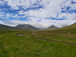
Beinn an Lochain is situated at the rest and be thankful carpark, only a few miles north of Arrochar. The car park is popular with tourists as it gives excellent views of the surrounding hills, the collective term for this being the Arrochar Alps. From Glasgow the drive is only an hour, up the side of Loch Lomond and can be reached quickly by car.
 |
| The Cobbler in the Distance |
 |
| The Loch at the Base of Beinn an Lochain |
From the car park the idea was to walk the length of the small loch at the foot of the hill and then cross over the river and walk up the ridge. I walked down to the head of the loch, by the time I had got around to the base of the hill both feet were soaking wet.
 |
| Loch Shore |
I considered the walk down to the river, and even though I was on the right side of it, it may well be extremely wet and boggy around that area. My idea was to start climbing, I figured the higher I go, the drier underfoot it would be. For a couple of hundred metres it was still boggy and difficult to judge where to place your feet because of the long grass. A couple of times I fell over because of the slippery moss on the side of the rocks. Despite this, I kept to my plan, which was to aim for a col, just under the 600m mark. The large rock formations on both sides of the area I was walking in helped with sheltering me from the wind. In just over an hour since I had started I got to the top of this section and I was able to see the track that would lead me on.
 |
| Heading for the Small Dip |
 |
| A Look Back at the Loch |
 |
| Right Track, Not the Top |
As always I thought that by getting to the top of the next section that I would reach the summit - rookie mistake. This part of the walk is steep but enjoyable since there is a track to follow. It can be a little muddy and slippery in places so it is best to take care when walking. The top of this section is at over 800m. The ridge that comes next is more exciting.
 |
| Track to the Top |
As you can see above, the ridge to the summit looks impressive and it is a good track to walk. There are a couple of exposed parts, so again care must be taken here. The track is mostly sheltered by the wind, but I can imagine it being quite tricky to walk up on a much wilder day.
 |
| Looking Back Down the Ridge |
 |
| The Summit |
I reached the summit in 2 hours and 20 minutes. My phone app actually recorded me being at 918m, which would technically be a Munro. From here I continued walking, there were a couple of smaller tops that I walked to before descending down the steep NE slope to the car park.
 |
| Looking back at the Summit |
 |
| I Descended down This |
 |
| A View of the Car Park |
It took just over 4 hours to complete the walk to the top and back. The app stopped tracking me after the summit but continued to record the time I had been out for. The total distance walked was only 4 km.


Comments
Post a Comment