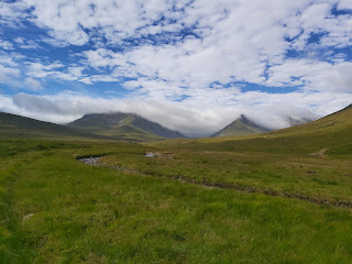
Falkirk to Linlithgow
 |
| Rail Bridge, Linlithgow |
How to get there
As always, if your getting public transport to Falkirk from Glasgow then the best bet would be the Edinburgh train from Glasgow Queen Street to Falkirk High train station. There is a regular bus service from Glasgow to Falkirk, although it is best to check the details of this at Buchanan Street station.
Distance and Elevation
The total distance for the walk to Linlithgow was only 12km, which was mainly on a canal path, as you can see with the elevation graph below there was a short ascent at the start of the walk, going through Callender Wood at the back of Callender park. The track was flat across the canal path but descends again at the end through the woods next to the river Avon.
 |
| Elevation of Route |
The Route
 |
| Map of Route |
I started the walk at Callendar House, which is the centre point of the park. After walking past it I turned left at the zip slide and followed the path around behind the large house. From there I took another left and headed up a short hill. From here I took a left again and this was the start of Callender Wood.
 |
| Callendar House |
 |
| Callendar Park |
Callendar Wood
This section was shorter than I expected, the tree lined path gave some shelter from the rain and I soon reached a green barrier and the remains of an old gate. Past this the route takes another left and this leads you down to a main road.
The sign was missing from the post but by consulting the map I took I right and then the next left where the track plunges back into the woods and under the railway bridge.
 |
| Callendar Wood |
 |
| Track through wood |
 |
| Main gate before the end |
Canal Walk - Again!
If the first few miles of the walk were fairly interesting, then it was about to end, with the main part of this route being along the canal. Now, I've said before that I've nothing against walking beside a canal, however I find that is does get a little bit boring after a while. It's just not my thing. Anyway, after the tunnel under the railway line, the path follows the canal for 8km or so. The canal path takes you past Polmont and the young offenders prison, Brightons, a Cafe that looked interesting but wasn't open when I went by. The highlight though was the Avon viaduct, which is where the canal crossed over the river Avon. The height of the viaduct is about 30m and provided good views over the surrounding area.
 |
| Tunnel under the railway line |
 |
| Union Canal |
 |
| Canal Boat |
 |
| Cafe |
 |
| Avon Viaduct |
With a couple of km left the route veers away from the canal and follows a woodland walk through the Avon Heritage Trail, which give information about the battle of Linlithgow in 1524. The woods are pleasant with good views of the river Avon. It brings you out under the large arches of the rail bridge at the far end of Linlithgow.
 |
| Woodland Walk |
 |
| Heritage Trail |
 |
| Typical Sign |
This was the end of my day walking this part of the John Muir Way. In total it took me 3 and half hours to complete the 12km route. I walked into the centre of town, which provides plenty of places to eat and drink, however I caught the next train back to Falkirk, a journey which took about 8 minutes.
 |
| Summary of Hike |


Comments
Post a Comment