John Muir Way: Section 3
Strathblane to Croy

How to Get There
From Glasgow I caught the early morning train to Milngavie. There is a regular service from Scotland's biggest city, and the entire journey only takes about 40 minutes. From the train station at Milngavie I got the B10 bus to Strathblane. This journey only takes just over 10 minutes. My commute took just over an hour to complete. At half seven in the morning, I was ready to start the next part of my journey.
Civilisation
I know that the John Muir Way isn't a trek through the wilderness, so when I say that the route passes through small villages and towns, it all sounds pretty obvious. However up until this stage you would move from urban area to countryside back to an urban area at the end. At section 3 of the walk, you pass through Lennoxtown and Kirkintilloch and smaller settlements like Milton of Campsite and Twecher. Unlike other walks where it is about getting to the next checkpoint, this section of the JMW can be enjoyed at a more leisurely pace. There are plenty of places to stop at for food and drink and so your pack can also be much lighter.
The Strathkelvin Railway Path

From the Kirkhouse Inn I walked up campsie road. Once past the church I crossed over and followed the sign for the Strathkelvin Railway path. This was once a railway line but has since been converted into a walking and cycle path. The path is sandwiched between 2 fields and runs parallel to the main road to Milton of Campsie, which means you always hear the sound of traffic as you walk.
 |
| Flat Path |
The most interesting aspect of the first section of this walk is Dunglass hill, a large lump of rock with some grass growing on top. I made a mental note to revisit here with the kids.
 |
| Dunglass Hill |
The path crosses a road at the 4 mile mark before the railway path again follows the river. It's quieter at this point and the smell of wild garlic is prevelent in the warm air. At this point the path is located behind a housing estate and this leads to the outskirts of Kirkintilloch.
The Canal Path
 |
| Start of the canal path |
The route cuts through Kirkintilloch. I was unsure of one of the signposts which makes you walk between the back of an industrial estate and a care home but the path ends up leading to the canal. The canal track is like all the rest. Again the canal runs parallel with the main road, along with building work meant that I had to walk a few miles before the path wound its way past fields and the noise faded away. After a couple of miles of canal path walking I was getting bored, but Twecher came into view and things were about to go more interesting.
 |
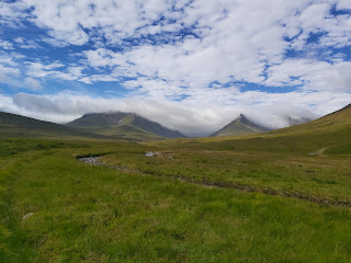
| Strathblane To Kilsyth |

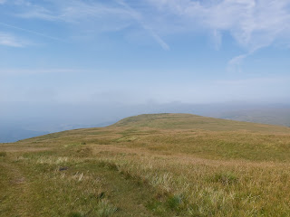
Bar Hill Fort

At Twecher there are two options, continue along the canal path, this is most suitable for cyclists. The second option is to ascend up and across Bar Hill Fort, the remnants of an old Roman garrison and is the walkers route. Naturally I took the latter option and ascended the shirt distance to the open field like summit. Here there are signs that show you what the fort was like and where everything was located.
 |
| The Bath House |
There isn't much left to see however it is a lovely space to sit in, and there are excellent views of the surrounding area. The track decends again along side the Antonine wall, the plush grass feeling soft and springy under foot.
 |
| Plush Grass |
The track decends to the B802, just outside of Croy. I decided to stop here instead of continuing over Croy hill. From this point Croy train station was less than a mile away and I was able to get a train back to Glasgow.
The next part of the John Muir Way is Croy to Falkirk which is just under 10 miles. No date for this has been set yet.

Comments
Post a Comment