Helensburgh to Balloch
 |
| Sculpture At The Start |
The John Muir Way comprises of 10 sections, which make the 134 mile distance. The Way starts at the Firth of Clyde and finishes on the Firth of Forth. My plan this year is to walk the route over the course of 2019 and the route primarily runs through the central belt, there is good access to public transport. The link to the route map is below.
John Muir Way Route Maps
How to get to Helensburgh.
Helensburgh is 20 miles west of Glasgow. If travelling by car from Glasgow head along the M8 west, following signs for the Erskine bridge and then Dumbarton. There is a regular bus service from Buchanan Street, however I decided to take the train from Queen Street station direct to Helensburgh. The overall journey by train is just under an hour.
Where does it start?
 |
| View over the Firth of Clyde |
The starting point is at Helensburgh pier, which over looks the Firth of Clyde. There is a couple of small statues that mark the start of the route. With regards to ammenaties, there are plenty of shops in which to buy food and drink, there is also a toilet block at the pier.
The Route
 |
| A Look Back |
From the pier, the route takes you east out the top end of Helensburgh. To begin with the path takes you past some of the larger houses Helensburgh has to offer. Once past the upper train station the route takes you past the Hill House, an important building designed by famous Scottish architect Charles Rennie Mackintosh. The building as per April 2019 is currently under renovation.
 |
| The Hill House |
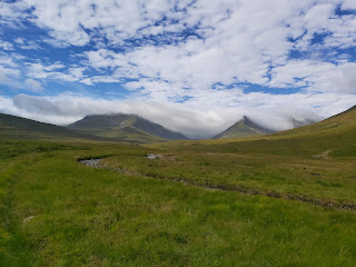
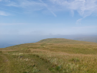
This section is firm under foot but can be mucky. The track is used by logging trucks and much of the surrounding woodland had been cut down, although this gives a better view of Loch Lomond. The track ascends here, but it is gentle enough that it shouldn't cause too much trouble. At the top of the rise it is possible to walk up to a view point to get a better view of Loch Lomond. After this, the track decends back through a small wooded area before heading out onto open hillside. The track is easy to follow and is wide enough to accommodate walkers and cyclists, and there are way signs located at regular intervals or John Muir stickers located on lamp posts, that you never feel unsure where to go.
 |
| One Type of Sign |
 |
| Another Type of Sign |
It's Downhill All The Way
After a few miles of this, the town of Balloch comes into sight. The track leads down to a bridge that crosses the A82 and then into Balloch. The walk makes its way past Loch Lomond Shores, a retail outlet that also has bars and restaurants.
On the day I walked this section (Sunday) there was a farmers market, which sold a whole array of hot food and gift items. This is useful as the entire first section should only take about 3-4 hours to walk and can be done so with a small day sack with water and snack items. As always I packed twice as much in the way of lunch than I needed.
Loch Lomond Shores
My day ended at Balloch train station and a trip back to Glasgow. My plan is to return to Balloch in a couple of weeks and take on the next section, between Balloch and Strathblane.


Comments
Post a Comment