Stob a' Choire Odhair
Munro: Stob a' Choire Odhair
Height: 945m
OS Map: 50
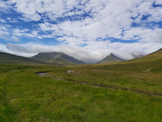
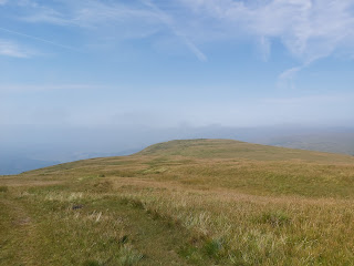
I had already tried this Munro before about 4 years ago and failed, getting lost in the mist and rain but I thought I would give it another crack. he weather report said it was going to be dry, which meant rain and sunny which meant fog. Undeterred I parked at Victoria Bridge, near Bridge of Orchy and got my boots etc on. I had noticed a lot of snow at the top of nearby mountains although the one I was doing which shorter than them and so I figured I would probably see a little frost and a smattering of snow at the top. Happily I trudged along the track next to the Abhainn Shira river until I reached a metal shack then I followed a mainly icy track up the Glen between Stob a' Choire Odhair and Stob Ghabhar. At just over 400m I took a well worn zig-zag path, the proper accent of the Munro. Again the icy was thicker and I had to tread carefully and just above me I spotted snow. I thought at the time it was a bit low down and by the time I reached 700m I was walking through an inch of snow. By the time I reached 840m I was up to my boots in snow, just as the mist closed in around me. The last hundred meters the snow reached halfway to my knee and I was beginning to doubt whether it was wise to carry on without crampons etc. I made it to the top in just over 2 hours but thought it wise not to try Stob Ghabhar.

Comments
Post a Comment