The Drumtochter Hills

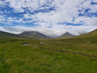
I had headed up to Drumtochter, just south of Dalwhinnie in the hope of getting some decent weather to attempt some Munros (Scottish mountains over 300ft). By chance the weather was sunny, for a change and so I had parked the car just by the Balsporren cottages. The Munros that I would be attempting were Gael-charn (917m), A’Mharconaich (975m), Beinn Udlamain (1011m) and Sgairneach Mhor (991m), a walking distance of approximately 15 miles. The ascent to Gael-charn is easy as the Munro basically faces you as you leave the car park to cross the railway line. Once at the summit of Gael-charn I descended down the loose rock side of the mountain to the col between it and A’Mharconaich. The path to the summit of the second Munro is boggy to begin with but dries out once you reach the broad shoulder of the Munro and the summit should take about an hour to walk to. From A’Mharconaich descend to the col to the start of Beinn Udlamain which ascends steeply to begin with before easing off. Navigation is easy due to the fact that old rusty fence posts act as markers to the stony summit. The climb to Sgairneach Mhor seems more imposing however as it looks like you have to descend some distance before walking back up Sgairneach Mhor. However you are only descending to about 800m before climbing back up the summit of the 4th Munro situated at 991m. Again the base of the Munro is quite boggy but the views are well worth it when you reach the top.


Comments
Post a Comment