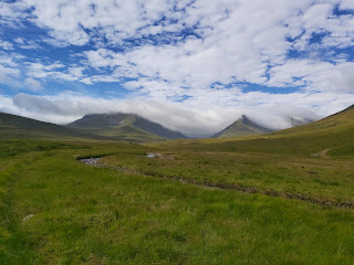
"It was a shame that for all the beauty of the scenery that the top of the mountain was covered in mist." Ben Alder and Ben Bheoil These two Munros stand south of Dalwhinnie in a remote part of Scotland. The best way of getting to them is to cycle out to Culra bothy, some 17km, which, I suppose is one way of warming up before a lengthy hike. These hills were not even on my radar for possible hills to visit but something happened that changed all that. I have had a mountain bike for over 20 years now, for over 15 years it has been covered up, sitting, rusting out the back. A few years ago I did replace the main gear cassette and chain however frustrated at not getting the gears working properly I gave up and left it. That was until the start of the summer. I had decided on not worrying about gears, all I wanted to do is to cycle and to have a bike that would be a low maintenance as possible. With that in mind I took the gear shifters off, pushed the rear mech back and fixed t...
Distance: 11.91km Time: 2 hrs 51min Ascent 781m The Route From the lay by next to the distillery, cross the road to the start of the walk to Dumgoyne. It is obvious to spot, a large open green lawn surface leads you up a tree lined rise to a stile. Green Lawn Path up to Dumgoyne Looking back Once over the fence, follow the muddy track up which bends to the right, under the top of Dumgoyne. It then ascends up onto the shoulder to the trig point. 57mins, 420m Dumgoyne Summit To get to Earl's Seat, descend off the back of Dumgoyne, this can be steep and tricky, especially when wet or cloudy. Follow the track east for 3.5km. There is a faint track for most of the walk. The summit of Earl's Seat runs alongside a fence to the trig point. 2hrs 5mins, 574m. You can return by the same direction, skirting around the base of Dumgoyne. Descending Dumgoyne Onward to Earl's Seat Towards Earl's Seat Summit of Earl's Seat This is a decent short hike walk with Munro like views...
Distance Walked: 5.76km Time Taken: 1 hour 57 min Route The route that we took for this walk is shown below. We started this walk in the centre of Strathaven, for a shorter walk it is possible to park at the waterfall car park in Sandford. This is a small village a couple of miles from Stathaven. As it was a nice day we decided on a slightly longer route starting at the carpark on Station Road. From here, we took a left out of the car park, along Station Road and then a right on the B7086. Road out of Strathavon View from The farm Track On the Right Track? This road takes you out of the town towards Sandford. After a couple of hundred metres out of the town we took the first farm track on the left. There is an official signpost further on, however, both routes end up in the same place later on. The farm track is scenic and muddy, the track bends towards the river and over what looks like a newly built bridge. There are some nice views of the river and the surrou...




Comments
Post a Comment